|
2005 Articles
We Saw What Other Cities and States Have Done
July 17 to August, 2005
Creek Walk, Jogging Trails and Greenways in
-
-
-
Austin, Texas
-
San Antonio, Texas
-
North Canadian River, Oklahoma City, Oklahoma
-
Bricktown Canal, Oklahoma City, Oklahoma
We Can Do It Too! The Time Is Now!
Call and Write our Mayor, each of Our Council Members, and each of our Jefferson County Commissioners (For more information call 798-0087)
SUBJECT:
|
River Walk & Greenway - San Antonio, Texas
Visited by Dr. Mable B. Anderson & Richard S. Woodruff, P.E.
President and Technical Director
Village Creek Society, Birmingham, Alabama
July 17, 2005
|
GENERAL
This prominent development of a creek walk in downtown San Antonio is located on the San Antonio River and has become a major tourist attraction. (We in Alabama would call it a "creek".) It consists of various commercial developments on both banks of natural drainage area through the urban city. This has taken place over a great many years.
Major hotels and department stores in the Central City are positioned on both sides of the river with lower level entrances to the river. This extends for several blocks with numerous street and pedestrian crossings. Very attractive landscaping with small parks have been developed and redeveloped on both sides of the river.
The river way walls were built of mortared stoned, with about a 6ft. wide sidewalk on each side. They were constructed along both sides of this natural drainage location to form a well defined channel. The walking area has been leveled with suitable fill to support lush vegetation. The city and businesses cooperated in their construction to develop a uniform and pleasing layout using greenery and trees to provide bank sides parks.
The channel had been dredged to some extent creating about a 4ft. depth of water. The bank concrete walkways are about 15 to 20 inches above the water surface. This treatment extends about 10 or 12 blocks to the City's north side or to the general limit of commercial development up-stream from Commerce Street. The walkways with walls provide a uniform waterway 35 to 40 ft. wide. The water level is controlled by a regulating dam downstream, with control gates. This is located beyond one of the larger area parks south of Commerce and Market Streets and all have well landscaped numerous tropical plantings.
It is assumed normal roof top and street drainage was piped into the waterway at appropriate intervals.
By a telephone call on August 17th to the Paseo del Rie Association (# 1-210-244-5700) the city information headquarters, we determined that the tour boats (water taxis) were 9ft. x 26ft. in size (small barges) equipped with seats. These barges were propelled by out-board motors with the operator/guide located on a small platform at the rear. Some smaller barges are in use for private parties (diner for two with table and server). The channel water was generally 3 to 5 ft. deep. The water level was controlled by slide gates at the dam downstream. There also was a water retaining structure upstream of Commerce Street on the north side of the developed area to restrict major flows due to storms. This limited discharges downstream so as to maintain a near "normal" level. By careful operations they have never had flooding over the walkways! All shops and restaurants have basement levels at the elevation of the river walk on both banks.
There are two or more short, side water channels extending off of the main river channel with an expansion of the downtown area, also with stores and developments at basements levels.
The historic Alamo is located within a couple of blocks of the River Walk area. Visitors parking lots and decks are conveniently located within a block or two of the River Walk area.
The attractive facilities along this River Walk though the downtown central city, with nearby interstate highways, have made this city of 1.1 million people a most desirable location for large national conferences and meetings all in a semi-tropical climate.
CLICK HERE TO VIEW PHOTOS!
SUBJECT:
River Walk & Greenway - Austin, Texas
Visited by Dr. Mable B. Anderson & Richard S. Woodruff, P.E.
President and Technical Director
Village Creek Society, Birmingham, Alabama
July 21, 2005
GENERAL
The city of Austin, Texas (The State Capital with a population of 650,000) is located on the Lower Colorado River in south central Texas. The Lower Colorado River Authority (LCRA) operates six (6) dams and power plants on this river producing power since about 1940. Its main dam, Tom Miller Dam (owned by the city of Austin) which forms Lake Austin, is located just downstream from the central city. It forms a reservoir about 1,200ft. wide extending about twenty (20) miles upstream to the next dam. Its banks through Austin, which were frequently flooded before its 1940 construction now have been very well developed by the city for recreational use. The maximum flood level of this lake has only been 2.4 feet (1981) since its construction, due to the well planned operation of the other five upstream power and water storage dams of the LCRA, which is a state owned and operated utility.
DESCRIPTION
This city is spread out on both banks of the "Lower Colorado River". Overtime, parkways have been developed rather extensively on both banks, with a single wide main hiking trail with fedder trails from parking locations which may be up to as much as a block away.
Parkways are generally, up to about 200 feet in width, sloping gently up from the waters edge (reservoir boundary owned by the city) to an adjacent street. The banks were nicely graded with well tended grass cover and tropical plantings. Some pipe guard rails were noted on gentle slopes. Trails were mostly compacted crushed stone about 10 to 12 feet wide and appeared to be built by NCRS* standards and are not suitable for skating. This park development extends for probably 2 or 3 miles on both sides of the river. They are connected by one foot bridge (vehicles barred) over the river in the downtown area.
No motor vehicles are allowed on the walkways, sometimes broken by a few steps, but are handicap accessible. They extend under the street bridges and have an occasional water fountain. Safety and directional signs are generally where needed with some signs having attached neat waste boxes with bags, requiring the owner to remove dog droppings.
We didn't notice any playgrounds for children or ball courts, but there is probably at least one on each side of the river as the length of this development probably has suitable headquaters with aid facilities also. Its maintenance is probably done by this capitol city's park and recreation board. The minimum elevation of the main trail (walk) is probably not lower than tree or four feet above normal water level so, floodwater has not been a major problem. A few community boat houses are on the banks for boat rentals.
This is a major park of the city of Austin and is well used by the public.
CLICK HERE TO VIEW PHOTOS!
* U.S. Dept. of Agriculture - Natural Resources Conservation Service
SUBJECT:
Bricktown Canal - Oklahoma City, OK
Visited by Dr. Mable B. Anderson & Richard S. Woodruff
Village Creek Society, Birmingham, Alabama
July 30, 31 & August 1, 2005
I. The Bricktown Canal is a part of a downtown entertainment district at the edge of the Commercial area. The original buildings are of brick and not in the high rent district.
The canal, probably a former natural drainage locations, is approximately 40ft. in width which has masonry side walls. The basements of the buildings are at the level of the creek walks on both sides of the canal with added landscaping, which is quite pleasing and is similar to the River Walk at San Antonio, Texas. This canal is about 1 mile in length with water taxis operating from one location, on a main street. The barges are the same as the ones operating on the San Antonio River Walk ( 9' x 26'). They have seats for about 36 people. The water surface is about 15 to 16 below the normal street levels. The south end of the canal is about 800 ft. from the river, but is not connected to the river. A new federal park under construction is located in the area. City water and well water is pumped into the canal for make-up at two locations at small overflow pools. Water is circulated from the canal to two overflow cascades, about 8ft. high, for aeration, and back to the canal. Two Rock Bands, one at a parking lot stand and one on a porch overlooking the canal were playing. The area was crowded on a Sat. & Sun. (no bands on Sun.). Two elevators were located, one on each side of a major street (Mickey Mantle Drive), as well as stairs, for convenience of access. A New Municipal Ball Park, and a stadium have been built near by, also a new bottling plant. The canal was about 4ft. in depth. A pizza shop occupied three floors of one of the older brick buildings. Boat rides were $6.00 and were mostly full (about 40 min. R.T. to each end of the canal). Pictures tell the rest of the story!
CLICK HERE TO VIEW PHOTOS!
SUBJECT:
River Walk & Greenway - North Canadian River - Oklahoma City, OK
Visited by Dr. Mable B. Anderson & Richard S. Woodruff
Village Creek Society, Birmingham, AlabamaJuly 30, 31 & August 1, 2005
GENERAL
A parkway is being developed on the North Canadian River for a seven mile section through the central part of the city. Riverside improvements are being made through a former floodway of the river parallel and just south of Interstate Forty. A parkway and future light industrial area is being developed from Meridian Avenue to Eastern Avenue (7 miles) and will greatly lessen the effects of a 100 year frequency flood.
Some clearing and regarding of an area about 500ft. on each side of the river has been essentially completed, including all inlet channels, with their banks stabilized by rewrap or concrete paving. Certain areas have been designated for future park & picnic sites. General landscaping is also under way with trees, grass and shrubbery. One new industrial plant (Dell Computers) has been built on project land made available to them at no cost. Others are to follow.
In 1999 a 1% sales tax was approved for five years for a MAPS Program (Metro Area Projects), which was extended one year. This produced 350 million dollars for various city urban projects and improvements, including rebuilding of the downtown "Mickey Mantle" ballpark at the Bricktown Canal amusement center. (See separate Report on this Canal.)
DETAILS
The river was improved by construction three low head (9 feet) dams to provide a minimum dept of six feet for future ferry and boating activities, as well as fishing.
An asphalt hiking trail 12 feet wide has been built on each side of the river generally 10 to 12 feet about normal river level (about the 100 year flood frequency elevation). The trail has 18 prefab steel footbridges ten feet wide with concrete floors, crossing various tributaries. No motor vehicles are allowed on the trail.
A boat launching ramp and boat yard is to be built this fall (2005) just upstream of a paved parking area with walks and curbs (for 72 cars). It will be used for future "skull" regattas. The first was held six months ago (spring 2005) with crews from major colleges participating (Harvard, Princeton, etc.) which was quite successful.
Near the downstream end of the developed area a new National Park to commemorate the "American Indian" is being constructed with a One Hundred Million Dollar budget (66 million federal and 33 million state).
STATISTICS
The three dams create pools about 400 ft. wide with each pool somewhat over 2 miles in length. Each pool is 9 ft. higher than its downstream pool. The lakes have been stocked with Blue and Channel Catfish. The banks are generally clean and clear of growth with riprap protection in the vicinity of each dam. The two upstream dams have boat locks ( 50' W x 100' L) at their north end (left side) for future water taxi service. Boats are planned for fifty (50) passengers, and could go up to 23 mph. Space is provided at the down stream dam for a future lock. This is in the vicinity of the new National Park commemoration "The American Indian". Many of whose ancestors were relocated to Oklahoma by the federal government, in the early 1800's, from the Mississippi Territory, (Mississippi-Alabama-Tennessee-Georgia).
The water level in the Bricktown Entertainment District Canal, nearby, is 18ft. higher then the water level in the river.
DAM GATES
These gates are called Crest Gates and are positioned on the top of a low concrete weir on the river bottom and between concrete piers. Hydraulic cylinders attached to the piers raise the gates, they are lowered by gravity action.
|
Location
|
Normal Pool Elevation (USGS)
|
No. of Spillway Gates
|
Size ( L x H)
|
How Operated
|
Nav. Lock Size
|
|
May Ave.
|
EI.1182
|
6
|
50' x 13'
|
Dual Hydraulic Cylinders each gate
|
50' x 100'
|
|
Western Ave.
|
EI.1173
|
6
|
50' x 13'
|
Dual Hydraulic Cylinders each gate
|
50' x 100'
|
|
Eastern Ave.
|
EI.1164
|
3
|
100' x 13'
|
Dual Hydraulic Cylinders each gate
|
Space Provided
|
Note:
All gates were heavily galvanized steel and then painted with a heavy coating of high quality paint. No provisions were made for major maintenance as they were expected to have a twenty-five to thirty year life and then generally replaced. A service building, about 25' square, for hydraulic equipment, controls and an emergency generator was located on the left bank of each dam.
MISCELLANEOUS
Some river bottom dredging was done downstream of the two upper dams to provide a minimum of a six feet depth in each lake. Dredge spoils were deposited in a spoil area on the river bank, about 3 miles upstream of the uppermost dam for future use. A permanent contract has been developed with a local contractor to maintain the 6 ft. depth in the future as needed. Periodic silting is a recognized on - going problem.
The U.S. Corps of Engineers and the U.S. Environment Protection Agency have approved the river central system for this project.
OPERATION
River water level is maintained in all pools by releases from several large upstream lakes and though gated conduits at each dam. Besides evaporation, the city uses some of the pool water for normal requirements. At the time of our visit, essentially no water overflowed or was released by the downstream dam and the river channel was practically dry and could be walked across.
Hydraulic equipment and gate controls, including the navigation lock gates, are located in a one story building, about 25 ft. square, with an emergency generator outside, all enclosed in a chain link fence for the operation of each dam.
The 3 river dams and locks cost $55,000.00. Current security is provided by two full time guards paid by the park board with four additional mounted officers from the City Police Department.
The "River Walk" grand opening occurred in 2004.
Many photographs were taken of this project.
FOR INFORMATION CONTACT:
MAPS Project - Public Works Department Oklahoma City, OK Phone: 1-405-297-2211
River Front Trail Specialist Mr. John Rhodes - Manager Phone: 1-405-297-3596
Mr. Mark Carleton - Asst. Manager Phone: 1-405-297-3466
Mr. Mark Beech - Asst. Manager Phone: 1-405-297-3467
Mr. Greg Crotchet - Maintenance Supervisor Phone: 1-405-919-7047
CLICK HERE TO VIEW PHOTOS!
A Message From VCS Advisory Board Team Leader William (Bill) Gilchrist
One of the most critical lessons our nation and the world should have learned, as we bore witness to a battered Gulf Coast, is the inescapable need to live in harmony together as a human family. Perhaps the most critical revelation from recent events is that these two imperatives can never be separated toward any good outcome for any significant time. I am of course, speaking about the havoc of Hurricane Katrina and the swatch of destruction it swept through Louisiana, Mississippi, and Alabama. In light of this devastation, the treatment of all peoples in those regions will be one of the most visible measures of our society's ultimate moral purpose towards crafting places for human habitation.
Under the leadership of Mayor Bernard Kincaid, the City of Birmingham is working assiduously to revitalize Village Creek as an amenity for enjoyment by all citizens and as an expression to the world of our care for the environment and each other. In succeeding in this mission, we will be talking steps to address decades of environmental disregard and human injustice. As a result, Village Creek will be transformed into a showcase of open space that will improve the quality of life for citizens from Pratt City to Roebuck. The help of all the neighborhoods along the creek, as well as the efforts of groups like the Village Creek Human and Environmental Justice Society, and partners like Jefferson County, will be critical to make this happen. While it would be a vast overstatement to equate our current situation along Village Creek with that of our human family along the Gulf Coast, if is no exaggeration to recognize that the same spirit of environmental deference, equity, and justice will be required for all of us to succeed at the respective tasks before us, irrespective of their scale.
Floodplain Acquisition Program Provides Relief to Village Creek Residents
by Edwin Revell
Approximately 15 years ago, the City of Birmingham implemented a floodplain property acquisition program administered by the Department of Plannings, Engineering and Permits to mitigate flooding and flood loses to citizens located in FEMA-designated, flood prone areas. To date, the City has acquired approximately 1,100 flood prone properties with a majority of those properties located in the Village Creek Watershed. With continuing its proactive approach, in 2004, the City was awarded approximately $4 million in Federal Emergency Management Agency (FEMA) grant funds to purchase approximately 100 properties that continuously flood in the Village Creek Watershed. Below is list along with a brief description of the current City of Birmingham buyout projects in the Village Creek Watershed.
-
-
City of Birmingham Floodway Property Acquisition Project - consists of approximately 37 floodway properties located in the Village Creek floodplain and in the North East Lake Neighborhood.
-
City of Birmingham Village Creek Floodplain Acquisition & Demolition Project - consists of approximately 65 floodplain properties located in the Village Creek floodplain and in the Collegeville and East Thomas Neighborhoods.
To meet the FEMA grant requirements, only those properties included in the above project with clear titles and willing sellers are being acquired. Although FEMA does not provide relocation assistance for property owners, qualified tenants are eligible to receive relocation assistance under the FEMA grants. Unlike past property acquisition projects, thanks to the Community Development Department, all eligible project participants may qualify to receive additional assistance through the City of Birmingham Special Flood Incentive Program. This Program, in conjunction with the recently established project Housing Relocation Committee, which consists of professional volunteers as well as representatives from the eight affected neighborhoods, will help to ensure that project participants are not only removed from the floodplain but also relocated to decent. safe and sanitary comparable dwellings outside of the floodplain but within the City Limits of Birmingham.
Those involved in this collaborative effort include the City of Birmingham Department of Planning, Engineering & Permits, the Community Development Department, the Department of Public Works, the Birmingham Homeownership Center and two project consultant teams. To date, approximately 30 floodplain property owners have been relocated from the floodplain as a result of these projects.
For more information about the City of Birmingham's floodplain property acquisition program or other floodplain related matters, please contact Edwin Revell (Flood Plain Administrator) or Denise Pruitt (Project Planner) at 205-254-2479.
VCS Works on Sharing and Recognizing History and Historical Sites in Ensley
Village Creek Society came into being because its founder, Dr. Mable Bell Anderson was born and grew up in the area. She says, "it is a mission for her parents and all the families that developed Moro Park Ensley."
After a meeting last year, at McAlpine Park located adjacent to Jackson-Olin High School, Mr. Robert Holmes, a senior member of First Baptist Church Ensley where her parents, before Mrs. Bell's death in 1991, were members from its beginnig in the 1920's, told President Anderson that his greatest wish was to see the parsonage a historical site. President Anderson made him a promise that she would seek to make his wish come true.
VCS Field Director, John Meehan, began the work on this project. He discovered that a member, Mr. Omie Crocket had purchased the parsonage and was diligently trying to maintain it and restore it.
VCS has been meeting with Mr. Crockett Sr. and with Mr. Ples Erskine Lewis, both First Baptist Church senior deacons, since December, 2005.
|
|

|
|
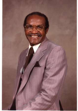
Mr. Robert Holmes Sr
"His wish came true"
|
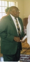
Mr. Ples Erskine Lewis
|
|
|

|
|
Mr. Omie Crocket Sr.
|
Mr. John Meehan
|
CLICK HERE TO VIEW MORE PHOTOS!
The Rev. A.D. King, First Baptist Church Ensley/Parsonage
and
Bombing of the Parsonage
During the 1960's, First Baptist Church Ensley was one of the 66 churches in Birmingham to hold Mass meetings during the Civil Rights Movement. The minister who served as pastor of First Baptist Church Ensley during that period was the Rev. A.D. King, brother of Dr. Martin Luther King Jr. His wife, Mrs. Naomi King was by his side.
Rev. King was very active and led many boycotts as well as demonstrations in Birmingham. On May 11, 1963, First Baptist Church Ensley parsonage in which Rev. King and his family lived was bombed. Rev. King and his family escaped the bombing by going out through their back garage. The community came for action! A riot was about to take place until Rev. King spoke though a bullhorn and urged everyone to go home. He let them see and know that he and his family were not injured.
On June 5,2006, though the Birmingham Historical Society, the 66 churches were honored at the 50th Anniversary at Old Sardis Church. Mr. Pledge Erskine Lewis took the lead with the VCS Committee in contacting Senior present and past members who participated in the Mass meetings at First Baptist Church Ensley to atten the event. Field Director Meehan contacted the King family and was able to get Mrs. Naomi King, the late Rev. A.D. King and family members to return. Mrs. Naomi King along with 4 grandchildren and a friend came. Mrs. King was eager to return to the parsonage. She relived and explained details of the bombing event and its affect on each room in the house. It was a fascinating oral history! Mr. Lewis and Mr. Crockett had arranged a homecoming at New First Baptist Church Ensley with greetings from the current Pastor, Rev. Thomas Gilmore, members and good food and flowers.
|